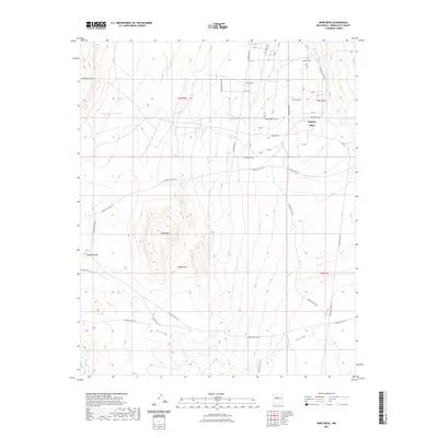
2023 Map of Wind Mesa
USGS Topo · Published 2023About this map
Wind Mesa and the elevated expanse of Pajarito Mesa dominate this southwestern Bernalillo County landscape, characterized by distinct geological formations and a network of service roads. The map illustrates a transition from the structured residential street names like John Muir Dr, Copernicus Dr, and La Perouse Dr in the northeast to the more utilitarian transit routes serving the high ground. To the south, the topography descends into drainage systems such as Cedar Wash, while the western edge is marked by the prominence of Blackbird Hill. This survey highlights the intersection of modern rural development and the traditional land management paths of the area, including Indian Svc Rte 611 and Los Padillas Rd, reflecting the complex infrastructure required to navigate this high-desert terrain.
Find a feature on this map
48 named features on this map. Tap any name to fly to it.
Don’t see what you’re looking for? This feature index may not catch every label — zoom into the map to look around manually.
Map Details
Editions of this 2023 Wind Mesa Map
This is the sole edition of this map. No revisions or reprints were ever made.
Other maps of this area

1888 · Bernalillo
USGS Topo · 1:125,000

1889 · Albuquerque
USGS Topo · 1:125,000

1893 · Albuquerque
USGS Topo · 1:125,000

1934 · West Albuquerque
USGS Topo · 1:24,000

1938 · Albuquerque
USGS Topo · 1:62,500

1952 · Wind Mesa
USGS Topo · 1:24,000

1952 · Dalies
USGS Topo · 1:24,000

1952 · Rio Puerco
USGS Topo · 1:24,000

1952 · Los Lunas
USGS Topo · 1:24,000

1952 · Isleta
USGS Topo · 1:24,000