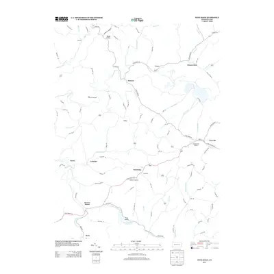
2013 Map of Wind Ridge
USGS Topo · Published 2013About this map
Wind Ridge serves as a central hub for this corner of Washington County, where the W Roy Furman Hwy connects the village to the Jacktown Fairgrounds. The landscape is defined by its deep drainages, including the N Fork Dunkard Fork and Enlow Fork, which have shaped the settlement patterns of agricultural hamlets like West Finley and Graysville. The presence of the Ryerson Station Reservoir at Ryerson Station indicates the importance of water management and recreation in the area.
Find a feature on this map
96 named features on this map. Tap any name to fly to it.
Don’t see what you’re looking for? This feature index may not catch every label — zoom into the map to look around manually.
Map Details
Editions of this 2013 Wind Ridge Map
This is the sole edition of this map. No revisions or reprints were ever made.
Other maps of this area

1902 · Wheeling
USGS Topo · 1:62,500

1904 · Cameron
USGS Topo · 1:62,500

1905 · Rogersville
USGS Topo · 1:62,500

1907 · Claysville
USGS Topo · 1:62,500

1935 · Cameron
USGS Topo · 1:62,500

1935 · Wheeling
USGS Topo · 1:62,500

1942 · Cameron
USGS Topo · 1:62,500

1942 · Wheeling
USGS Topo · 1:62,500

1949 · Clarksburg
USGS Topo · 1:250,000

1951 · Canton
USGS Topo · 1:250,000
Featured Places
- East Finley Township, PA
- West Finley Township, PA
- Enon, East Finley Township
- Richhill Township, PA
- Bryan, PA