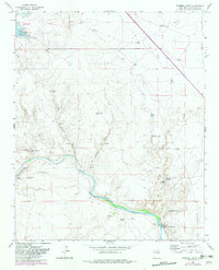
1965 Map of Windmill Draw
USGS Topo · Published 1982About this map
Sumner Lake State Park and the high desert rangelands of De Baca County define this landscape during the mid-1960s. The Pecos River carves a winding path through the center of the sheet, bordered by distinctive landmarks like Pacheco Bluff and the dry reaches of Windmill Draw. This arid territory is marked by the infrastructure of ranching life, featuring several established family operations such as York Ranch, Walton Ranch, and Brassell Ranch. Water management is the primary industrial focus, evidenced by the Fort Sumner Diversion Dam and an extensive network of named water sources like Carretas Springs and Old Water Hole. Numerous windmills, including the Shipping Trap Windmill and Star Windmill, illustrate the methods used to sustain livestock across these vast New Mexico grazing lands.
Find a feature on this map
41 named features on this map. Tap any name to fly to it.
Don’t see what you’re looking for? This feature index may not catch every label — zoom into the map to look around manually.
Map Details
Editions of this 1965 Windmill Draw Map
2 editions found
Other maps of this area

1954 · Fort Sumner
USGS Topo · 1:250,000

1958 · Fort Sumner
USGS Topo · 1:250,000

1965 · Fort Sumner West
USGS Topo · 1:24,000

1965 · Windmill Draw
USGS Topo · 1:24,000

1966 · Gibbons Ranch
USGS Topo · 1:24,000

1966 · Ricardo
USGS Topo · 1:24,000

1966 · Alamogordo Dam
USGS Topo · 1:24,000

1966 · Colorado Canyon
USGS Topo · 1:24,000

1968 · Twin Mesa NW
USGS Topo · 1:24,000

1968 · Fort Sumner East
USGS Topo · 1:24,000