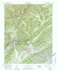
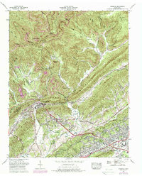
1968 Map of Windrock
USGS Topo · Published 1984About this map
Windrock Mountain and the surrounding ridges of the Cumberland Mountains dominate this landscape where the boundaries of Anderson, Morgan, and Roane counties converge. Extensive strip mining activity is evident across Buffalo Mountain and Lick Ridge, highlighting the region's industrial reliance on coal. In the valley below, the established community of Oliver Springs serves as a central hub, connected by the Southern Railway and the Louisville and Nashville Railroad.
Find a feature on this map
86 named features on this map. Tap any name to fly to it.
Don’t see what you’re looking for? This feature index may not catch every label — zoom into the map to look around manually.
Map Details
Editions of this 1968 Windrock Map
5 editions found
Other maps of this area

1893 · Briceville
USGS Topo · 1:125,000

1895 · Loudon
USGS Topo · 1:125,000

1895 · Briceville
USGS Topo · 1:125,000

1896 · Briceville
USGS Topo · 1:125,000

1935 · Elverton
USGS Topo · 1:24,000

1935 · Bethel Valley
USGS Topo · 1:24,000

1935 · Lovell
USGS Topo · 1:24,000

1936 · Hogbell Gap
USGS Topo · 1:24,000

1936 · Duncan Flats
USGS Topo · 1:24,000

1936 · Windrock
USGS Topo · 1:24,000