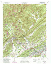
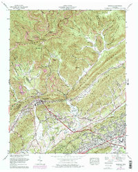
1968 Map of Windrock
USGS Topo · Published 1987About this map
Windrock Mountain and the steep slopes of Walden Ridge dominate this Tennessee landscape, where heavy extraction and scientific expansion intersect. Numerous strip mines scar the northern ridges above Windrock, Upper Windrock, and Windrock Fields, documenting the intensive coal mining operations of the late 1960s. In the valley below, the rail infrastructure of the Southern Railway and Louisville and Nashville Railroad converges near Oliver Springs, a hub at the triple-county junction of Anderson, Roane, and Morgan. The southeastern portion of the map reveals the planned growth of Oak Ridge, featuring the Oak Ridge Airpark, the Atomic Energy Museum, and a drive-in theater. Throughout the hollows, family legacies remain visible through numerous burial grounds like Harkness Cem and Hoskins Cem, alongside rural landmarks such as Big Mountain Church.
Find a feature on this map
69 named features on this map. Tap any name to fly to it.
Don’t see what you’re looking for? This feature index may not catch every label — zoom into the map to look around manually.
Map Details
Editions of this 1968 Windrock Map
5 editions found
Other maps of this area

1893 · Briceville
USGS Topo · 1:125,000

1895 · Loudon
USGS Topo · 1:125,000

1895 · Briceville
USGS Topo · 1:125,000

1896 · Briceville
USGS Topo · 1:125,000

1935 · Elverton
USGS Topo · 1:24,000

1935 · Bethel Valley
USGS Topo · 1:24,000

1935 · Lovell
USGS Topo · 1:24,000

1936 · Hogbell Gap
USGS Topo · 1:24,000

1936 · Duncan Flats
USGS Topo · 1:24,000

1936 · Windrock
USGS Topo · 1:24,000