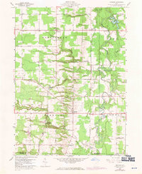
1959 Map of Windsor
USGS Topo · Published 1971About this map
The Grand River and its numerous tributaries, including Phelps Creek and Indian Creek, dominate this rural corner of the Connecticut Western Reserve. In the mid-20th century, the landscape is defined by its agrarian roots and family-named hollows like White Hollow and Hoskins Hollow. Small crossroads settlements such as Windsor Mills and Stoneville appear alongside evidence of local recreation and resource extraction, ranging from Camp Whitewood in the south to a Gaging Station and Gravel Pit. The map documents the boundary between Ashtabula and Trumbull Counties, capturing the transition between the townships of Hartsgrove, Rome, and Windsor. A network of unpaved roads and distinct field lines, many photo-revised in 1970, shows the persistent agricultural structure of the area. Local history and genealogy are well-represented by several burial grounds, including Pioneer Cem and Loomis Cem, and the community hub of Grand Valley Ch.
Find a feature on this map
52 named features on this map. Tap any name to fly to it.
Don’t see what you’re looking for? This feature index may not catch every label — zoom into the map to look around manually.
Map Details
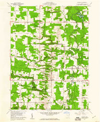
Editions of this 1959 Windsor Map
2 editions found
Other maps of this area

1904 · Chardon
USGS Topo · 1:62,500

1905 · Bristolville
USGS Topo · 1:62,500

1905 · Garrettsville
USGS Topo · 1:62,500

1905 · Jefferson
USGS Topo · 1:62,500

1906 · Chardon
USGS Topo · 1:62,500

1907 · Bristolville
USGS Topo · 1:62,500

1907 · Jefferson
USGS Topo · 1:62,500

1907 · Garrettsville
USGS Topo · 1:62,500

1950 · Cleveland
USGS Topo · 1:250,000

1952 · West Farmington
USGS Topo · 1:24,000
Featured Places
- Mesopotamia Township, OH
- Windsor, OH
- Hartsgrove Township, OH
- Hartsgrove, Hartsgrove Township
- Bloomfield Township, OH