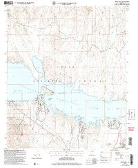
2004 Map of Windy Hill
USGS Topo · Published 2007About this map
Tonto National Forest surrounds the deep turquoise waters of Theodore Roosevelt Lake (Salt River), revealing a landscape where recreation and conservation converge. The map documents the intricate shoreline at Spillway Elevation 2120, featuring prominent landforms such as Windy Hill and Steamboat Rock. To the southwest, the Tonto National Monument protects archaeological resources near Honey Butte and Porter Springs, while the Roosevelt Lake State Wildlife Area marks the northern reaches of the lake.
Find a feature on this map
48 named features on this map. Tap any name to fly to it.
Don’t see what you’re looking for? This feature index may not catch every label — zoom into the map to look around manually.
Map Details
Editions of this 2004 Windy Hill Map
This is the sole edition of this map. No revisions or reprints were ever made.
Other maps of this area

1907 · Roosevelt
USGS Topo · 1:125,000

1909 · Four Peaks
USGS Topo · 1:125,000

1912 · Roosevelt
USGS Topo · 1:125,000

1922 · Chrysotile
USGS Topo · 1:125,000

1949 · McFadden Peak
USGS Topo · 1:62,500

1949 · Rockinstraw Mtn
USGS Topo · 1:62,500

1950 · Rockinstraw Mtn
USGS Topo · 1:62,500

1950 · McFadden Peak
USGS Topo · 1:62,500

1954 · Mesa
USGS Topo · 1:250,000

1957 · Mesa
USGS Topo · 1:250,000