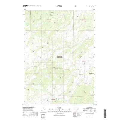
2017 Map of Windy Peak
USGS Topo · Published 2017About this map
Medicine Bow National Forest dominates this section of the Laramie Range along the Albany and Converse County line. The high-elevation terrain is defined by a series of prominent summits including Windy Peak, Eagle Peak, and Buzzard Peak, which are linked by a network of drainage systems like N Horseshoe Cr and Roaring Fork. A distinct human imprint is visible through legacy names on the landscape, such as Graveyard Hill and Trethway Mtn The Needles, indicating the importance of local family names and landmarks in this wilderness area. Primitive transportation routes like Devils Pass Rd and the Eagle Peak Trl navigate the complex topography, connecting remote points like Devils Pass and Shepherd Springs. The map illustrates a landscape of high ridges and deep canyons, such as Big Bear Canyon, where water sources like Wagon Wheel Spring were essential for early travel and land use.
Find a feature on this map
62 named features on this map. Tap any name to fly to it.
Don’t see what you’re looking for? This feature index may not catch every label — zoom into the map to look around manually.
Map Details
Editions of this 2017 Windy Peak Map
This is the sole edition of this map. No revisions or reprints were ever made.
Other maps of this area

1943 · Esterbrook
USGS Topo · 1:62,500

1945 · Esterbrook
USGS Topo · 1:62,500

1954 · Torrington
USGS Topo · 1:250,000

1958 · Torrington
USGS Topo · 1:250,000

1964 · Toltec
USGS Topo · 1:24,000

1964 · School Section Mountain
USGS Topo · 1:24,000

1964 · Saddleback Mountain
USGS Topo · 1:24,000

1964 · Windy Peak
USGS Topo · 1:24,000

1968 · Cow Creek Mountain
USGS Topo · 1:24,000

1968 · Cottonwood Creek
USGS Topo · 1:24,000