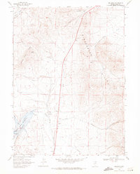
1968 Map of Wine Cup Ranch SW
USGS Topo · Published 1980About this map
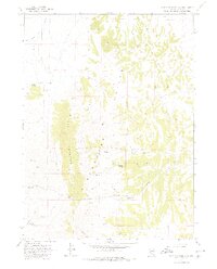
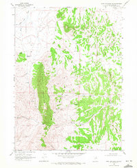
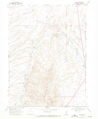
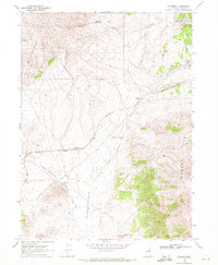
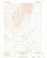
Black Mountain and the Deer Hills define this high-desert landscape in Elko County, Nevada, as it appeared in the late 1960s. The topography is dominated by north-south ridges and deep drainages like Hunter Draw, where seasonal water sources were critical for ranching and prospecting operations. Scattered Mines north of Tripon Pass suggest a history of exploration in the high country, while several Well and spring sites like Thurston Spring and Brush Creek Springs indicate the vital importance of water management in this arid environment. The map records a complex network of seasonal drainages, including Willow Creek, Cricket Springs, and Deadman Creek, which carve through the high elevations to the valley floors below.
Find a feature on this map
17 named features on this map. Tap any name to fly to it.
Don’t see what you’re looking for? This feature index may not catch every label — zoom into the map to look around manually.
Map Details
Editions of this 1968 Wine Cup Ranch SW Map
2 editions found
Other maps of this area

1955 · Wells
USGS Topo · 1:250,000

1958 · Wells
USGS Topo · 1:250,000

1961 · Wells
USGS Topo · 1:250,000
1968 · Wilkins
USGS Topo · 1:24,000
1968 · Holborn
USGS Topo · 1:24,000
1968 · Melandco
USGS Topo · 1:24,000
1968 · Pequop
USGS Topo · 1:24,000
1968 · Wells Peak
USGS Topo · 1:24,000
1968 · Wine Cup Ranch SE
USGS Topo · 1:24,000
1968 · Wine Cup Ranch
USGS Topo · 1:24,000