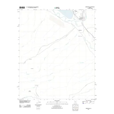
2011 Map of Winkelman
USGS Topo · Published 2011About this map
The confluence of the Gila River and the San Pedro River anchors this desert landscape in south-central Arizona. The town of Winkelman sits just southeast of Hayden, serving as a central hub where the Winkelman Post Office and local streets like Sayco Ave and Thorne Ave define the settled area. To the south, Dudleyville stretches along the river valley, evidenced by the Dudleyville Cemetery and local residential routes like N Watercress Dr.
Find a feature on this map
31 named features on this map. Tap any name to fly to it.
Don’t see what you’re looking for? This feature index may not catch every label — zoom into the map to look around manually.
Map Details
Editions of this 2011 Winkelman Map
This is the sole edition of this map. No revisions or reprints were ever made.
Other maps of this area

1910 · Ray
USGS Topo · 1:62,500

1911 · Winkelman
USGS Topo · 1:125,000

1913 · Winkelman
USGS Topo · 1:125,000

1915 · Christmas
USGS Topo · 1:62,500

1917 · Christmas
USGS Topo · 1:62,500

1949 · Holy Joe Peak
USGS Topo · 1:62,500

1949 · Crozier Peak
USGS Topo · 1:24,000

1949 · Winkelman
USGS Topo · 1:24,000

1949 · Winkelman
USGS Topo · 1:62,500

1949 · Saddle Mtn.
USGS Topo · 1:24,000