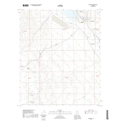
2018 Map of Winkelman
USGS Topo · Published 2018About this map
Hayden and Winkelman anchor the northern landscape of this region, situated where the terrain transitions toward the Gila River valley. In this 2018 survey, the proximity of these two towns highlights the industrial and residential development concentrated along the river corridor. To the south, the settlement of Dudleyville provides a distinct point of interest for researchers tracking the expansion of local communities in Pinal and Gila counties. The map effectively illustrates the road networks and settlement patterns that have shaped this portion of the Arizona desert, offering a clear record of the area's modern infrastructure and geography.
Find a feature on this map
3 named features on this map. Tap any name to fly to it.
Don’t see what you’re looking for? This feature index may not catch every label — zoom into the map to look around manually.
Map Details
Editions of this 2018 Winkelman Map
This is the sole edition of this map. No revisions or reprints were ever made.
Other maps of this area

1910 · Ray
USGS Topo · 1:62,500

1911 · Winkelman
USGS Topo · 1:125,000

1913 · Winkelman
USGS Topo · 1:125,000

1915 · Christmas
USGS Topo · 1:62,500

1917 · Christmas
USGS Topo · 1:62,500

1949 · Holy Joe Peak
USGS Topo · 1:62,500

1949 · Crozier Peak
USGS Topo · 1:24,000

1949 · Winkelman
USGS Topo · 1:24,000

1949 · Winkelman
USGS Topo · 1:62,500

1949 · Saddle Mtn.
USGS Topo · 1:24,000