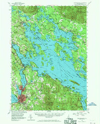
1956 Map of Winnipesaukee
USGS Topo · Published 1971About this map
Lake Winnipesaukee dominates this mid-century survey, revealing the intricate shoreline and island geography of New Hampshire's Lakes Region during the 1950s. The map details a landscape transitioning from rural farming and timber heritage into a premier summer destination, centered around the industrial and transport hub of Laconia and the growing resort village of Weirs Beach. Navigation and leisure take center stage, with the Mt Washington Boat Route weaving through major islands like Bear Island, Long Island, and Rattlesnake Island.
Find a feature on this map
100 named features on this map. Tap any name to fly to it.
Don’t see what you’re looking for? This feature index may not catch every label — zoom into the map to look around manually.
Map Details
Editions of this 1956 Winnipesaukee Map
4 editions found

Other maps of this area

1909 · Winnepesaukee
USGS Topo · 1:62,500

1919 · Gilmanton
USGS Topo · 1:62,500

1919 · Alton
USGS Topo · 1:62,500

1925 · Holderness
USGS Topo · 1:62,500

1927 · Penacook
USGS Topo · 1:62,500

1927 · Gilmanton
USGS Topo · 1:62,500

1927 · Holderness
USGS Topo · 1:62,500

1928 · Wolfeboro
USGS Topo · 1:62,500

1928 · Plymouth
USGS Topo · 1:62,500

1930 · Ossipee Lake
USGS Topo · 1:62,500