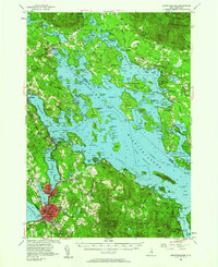
1956 Map of Winnipesaukee
USGS Topo · Published 1980About this map
Lake Winnipesaukee serves as the central hub of this mid-century New Hampshire landscape, with its sprawling shoreline connecting established lakefront communities and remote island outposts. The map documents the industrial and transportation nexus at Laconia, where the Boston and Maine railroad line skirts Opechee Bay and Paugus Bay near Lakeport. The era's recreational growth is evident in the development around Weirs Beach and the presence of the Laconia Airport, alongside numerous religious and educational institutions like La Salette Sem and the Perley Pond Sch.
Find a feature on this map
90 named features on this map. Tap any name to fly to it.
Don’t see what you’re looking for? This feature index may not catch every label — zoom into the map to look around manually.
Map Details
Editions of this 1956 Winnipesaukee Map
4 editions found

Other maps of this area

1909 · Winnepesaukee
USGS Topo · 1:62,500

1919 · Gilmanton
USGS Topo · 1:62,500

1919 · Alton
USGS Topo · 1:62,500

1925 · Holderness
USGS Topo · 1:62,500

1927 · Penacook
USGS Topo · 1:62,500

1927 · Gilmanton
USGS Topo · 1:62,500

1927 · Holderness
USGS Topo · 1:62,500

1928 · Wolfeboro
USGS Topo · 1:62,500

1928 · Plymouth
USGS Topo · 1:62,500

1930 · Ossipee Lake
USGS Topo · 1:62,500