
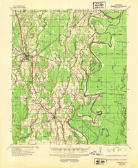
1935 Map of Winnsboro
USGS Topo · Published 1936About this map
The Missouri Pacific railroad corridor serves as the primary spine for settlement in Franklin Parish during the mid-1930s, connecting the commercial centers of Winnsboro and Gilbert. This survey captures a rural landscape defined by an intricate network of river crossings and riparian industry. Extensive timber operations are evident through the Chicago Mill & Lumber Company and numerous logging landings like Board Tree Lake and Fisher Lake along the southern bayous.
Find a feature on this map
53 named features on this map. Tap any name to fly to it.
Don’t see what you’re looking for? This feature index may not catch every label — zoom into the map to look around manually.
Map Details
Editions of this 1935 Winnsboro Map
2 editions found
Other maps of this area

1935 · Alto
USGS Topo · 1:62,500

1935 · Baskinton
USGS Topo · 1:62,500

1935 · Waverly
USGS Topo · 1:62,500

1935 · Shackleford Lake
USGS Topo · 1:62,500

1939 · Fort Necessity
USGS Topo · 1:62,500

1939 · Locust Ridge
USGS Topo · 1:62,500

1941 · Sicily Island
USGS Topo · 1:62,500

1941 · Harrisonburg
USGS Topo · 1:62,500

1953 · Natchez
USGS Topo · 1:250,000

1955 · Jackson
USGS Topo · 1:250,000