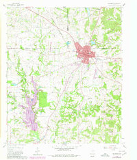
1960 Map of Winnsboro
USGS Topo · Published 1980About this map
The Louisiana and Arkansas Railway bisects the landscape of Northeast Texas, serving as the industrial spine for the city of Winnsboro. This 1960 survey, updated with 1980 photorevisions, highlights the intersection of the Hopkins and Wood County lines, an area dominated by energy extraction. The extensive Pickton Oil Field to the northwest and the Winnsboro Oil Field to the south illustrate the era's heavy reliance on petroleum. Beyond the urban grid of Winnsboro, which includes landmarks like the Winnsboro Municipal Airport and High Sch, the map reveals a rural network of community centers such as Tinney Chapel, Forest Home Ch, and Wylie Memorial Ch. Water management is evident through the sprawl of Winnsboro Lake and Lake Franklin, while the underlying terrain is defined by the drainage of Big Creek and Sandy Creek.
Find a feature on this map
54 named features on this map. Tap any name to fly to it.
Don’t see what you’re looking for? This feature index may not catch every label — zoom into the map to look around manually.
Map Details
Editions of this 1960 Winnsboro Map
3 editions found
Other maps of this area

1953 · Texarkana
USGS Topo · 1:250,000

1956 · Texarkana
USGS Topo · 1:250,000

1956 · Tyler
USGS Topo · 1:250,000

1960 · Winnsboro
USGS Topo · 1:24,000

1960 · Cartwright
USGS Topo · 1:24,000

1960 · Newsome
USGS Topo · 1:24,000

1960 · Rhonesboro
USGS Topo · 1:24,000

1960 · Pleasant Grove
USGS Topo · 1:24,000

1960 · Quitman
USGS Topo · 1:24,000

1964 · Como
USGS Topo · 1:24,000