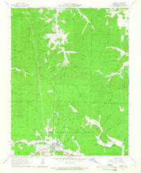
1965 Map of Winona
USGS Topo · Published 1966About this map
Winona serves as the primary hub in this mid-1960s Ozark landscape, established at the intersection of the St Louis-San Francisco railroad and the local creek systems. Much of the surrounding territory is managed as the Mark Twain National Forest, though the map reveals signs of human labor in the rugged terrain through features like the Sutton Mine in Sutton Hollow and the small settlement of Munsell to the north.
Find a feature on this map
60 named features on this map. Tap any name to fly to it.
Don’t see what you’re looking for? This feature index may not catch every label — zoom into the map to look around manually.
Map Details
Editions of this 1965 Winona Map
3 editions found
Other maps of this area

1915 · Eminence
USGS Topo · 1:62,500

1917 · Eminence
USGS Topo · 1:62,500

1928 · Cardareva
USGS Topo · 1:62,500

1931 · Bandyville
USGS Topo · 1:48,000

1944 · Van Buren
USGS Topo · 1:62,500

1944 · Birch Tree
USGS Topo · 1:62,500

1946 · Van Buren
USGS Topo · 1:62,500

1948 · Birch Tree
USGS Topo · 1:62,500

1949 · Rolla
USGS Topo · 1:250,000

1949 · Cardareva
USGS Topo · 1:62,500