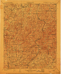
1901 Map of Winslow
USGS Topo · Published 1913About this map
The St Louis and San Francisco RR carves a critical path through the Boston Mountains, connecting early 20th-century communities like Winslow and Brentwood. This period in Northwest Arkansas and the Arkansas Indian Territory borderlands shows a landscape transitioning from pioneer agriculture to a more integrated rail economy. The historic Old Wire Road is visible alongside the railway, tracing an older route of communication and travel.
Find a feature on this map
122 named features on this map. Tap any name to fly to it.
Don’t see what you’re looking for? This feature index may not catch every label — zoom into the map to look around manually.
Map Details
Editions of this 1901 Winslow Map
5 editions found

Other maps of this area

1879 · Cravens
USGS Topo · 1:62,500

1879 · Fort Smith
USGS Topo · 1:62,500

1887 · Van Buren
USGS Topo · 1:62,500

1887 · Magazine Mountain #2
USGS Topo · 1:62,500

1887 · Watalula
USGS Topo · 1:62,500

1887 · Magazine Mountain
USGS Topo · 1:62,500

1890 · Magazine Mountain
USGS Topo · 1:125,000

1890 · Fort Smith
USGS Topo · 1:125,000

1898 · Winslow #4
USGS Topo · 1:62,500

1898 · Winslow #3
USGS Topo · 1:62,500