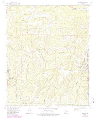
1973 Map of Winslow
USGS Topo · Published 1987About this map
The town of Winslow sits at the high point of this Ozark plateau landscape, where the headwaters of the West Fork White River meet the deep drainages of the southern watershed. In the early 1970s, the Burlington Northern railroad carved a vital north-south path through the center of the quadrangle, passing through the rugged terrain near Boston. The map reveals a dispersed settlement pattern defined by hollows and ridges, with family and community life centered around places like Blackburn Ch, Bethlehem Ch, and the Collier Cem. The southwestern corner is dominated by the protected lands of Devils Den State Park, while the Ozark National Forest borders much of the surrounding area. Notable landmarks such as Gaylor Mountain and the steep Rotten Bluff illustrate the dramatic topography that dictated the placement of early mountain roads and homesteads like Banyard.
Find a feature on this map
43 named features on this map. Tap any name to fly to it.
Don’t see what you’re looking for? This feature index may not catch every label — zoom into the map to look around manually.
Map Details
Editions of this 1973 Winslow Map
3 editions found
Other maps of this area

1898 · Winslow #4
USGS Topo · 1:62,500

1898 · Winslow #3
USGS Topo · 1:62,500

1898 · Winslow
USGS Topo · 1:125,000

1901 · Winslow
USGS Topo · 1:125,000

1946 · Fort Smith
USGS Topo · 1:250,000

1965 · Fort Smith
USGS Topo · 1:250,000

1967 · Fort Smith
USGS Topo · 1:250,000
1969 · Fern
USGS Topo · 1:24,000
1969 · Mountainburg
USGS Topo · 1:24,000
1970 · Rudy NE
USGS Topo · 1:24,000