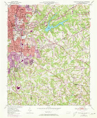
1950 Map of Winston-Salem East
USGS Topo · Published 1973About this map
Winston-Salem undergoes a period of significant post-war expansion in this mid-century topographic record, which highlights the densifying urban core and its emerging eastern suburbs. The map reveals a transition from the established institutional grounds of Salem College and Winston-Salem State University to the industrial and logistical hubs flanking the Southern railroad. To the east, the waters of Salem Lake and Winston Lake punctuate a landscape of undulating terrain, while the massive Piedmont Quarry indicates the area's ongoing resource extraction. The 1970s revisions, visible in purple, trace the rapid growth of residential tracts like Columbia Heights and Easton View, illustrating how the city moved past its historic Salem roots. Further out, the rural character remains through numerous country churches like Friedland Ch and Oak Grove Ch, which stand as landmarks for local genealogists and historians.
Find a feature on this map
85 named features on this map. Tap any name to fly to it.
Don’t see what you’re looking for? This feature index may not catch every label — zoom into the map to look around manually.
Map Details
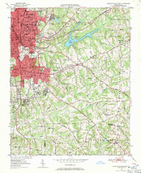
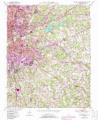
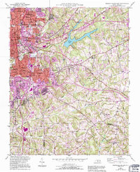
Editions of this 1950 Winston-Salem East Map
5 editions found
Other maps of this area

1949 · Eller
USGS Topo · 1:24,000

1949 · High Point West
USGS Topo · 1:24,000

1950 · Winston-Salem West
USGS Topo · 1:24,000

1950 · Winston-Salem East
USGS Topo · 1:24,000

1951 · Winston-Salem West
USGS Topo · 1:24,000

1951 · Winston-Salem East
USGS Topo · 1:24,000

1951 · Rural Hall
USGS Topo · 1:24,000

1951 · Walkertown
USGS Topo · 1:24,000

1953 · Charlotte
USGS Topo · 1:250,000

1953 · Winston-Salem
USGS Topo · 1:250,000