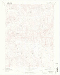
1968 Map of Winter Flats
USGS Topo · Published 1972About this map
South Shale Ridge dominates this high-altitude landscape on the border of Garfield and Mesa counties, where a complex network of canyons and gulches drains toward the south. The terrain is defined by the massive drainage systems of Main Canyon and Pine Gulch, which slice through the elevated plateau. A single Drill Hole in the center of the ridge provides evidence of geological exploration in an otherwise non-industrial wilderness.
Find a feature on this map
26 named features on this map. Tap any name to fly to it.
Don’t see what you’re looking for? This feature index may not catch every label — zoom into the map to look around manually.
Map Details
Editions of this 1968 Winter Flats Map
2 editions found
Other maps of this area

1929 · Roan Creek
USGS Topo · 1:62,500

1955 · Cameo
USGS Topo · 1:24,000

1956 · Grand Junction
USGS Topo · 1:250,000

1959 · Grand Junction
USGS Topo · 1:250,000

1960 · Grand Junction
USGS Topo · 1:250,000

1962 · Grand Junction
USGS Topo · 1:250,000
1962 · Round Mountain
USGS Topo · 1:24,000

1962 · Corcoran Point
USGS Topo · 1:24,000

1964 · Grand Junction
USGS Topo · 1:250,000

1965 · Grand Junction
USGS Topo · 1:250,000