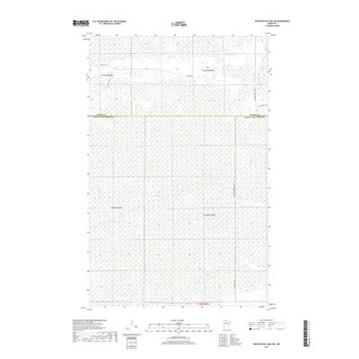
2019 Map of Winter Road Lake NW
USGS Topo · Published 2019About this map
The East Warroad River winds through this expanse of northern Minnesota wetlands and timberland, providing a primary drainage route for the low-lying terrain. This region, positioned at the boundary of Roseau and Lake of the Woods counties, is characterized by its isolation and dense network of forest access routes. The map documents a landscape defined more by its forestry management than by permanent settlements, with naming conventions heavily influenced by the local road and trail systems.
Find a feature on this map
13 named features on this map. Tap any name to fly to it.
Don’t see what you’re looking for? This feature index may not catch every label — zoom into the map to look around manually.
Map Details
Editions of this 2019 Winter Road Lake NW Map
This is the sole edition of this map. No revisions or reprints were ever made.
Other maps of this area

1918 · Winterroad
USGS Topo · 1:62,500

1918 · Roosevelt
USGS Topo · 1:62,500

1918 · Warroad
USGS Topo · 1:62,500

1943 · Roosevelt
USGS Topo · 1:62,500

1943 · Warroad
USGS Topo · 1:62,500

1954 · Roseau
USGS Topo · 1:250,000

1957 · Roseau
USGS Topo · 1:250,000

1958 · Roseau
USGS Topo · 1:250,000
1967 · Roosevelt
USGS Topo · 1:24,000
1967 · Warroad SE
USGS Topo · 1:24,000