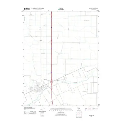
2012 Map of Winters
USGS Topo · Published 2012About this map
Winters serves as the focal point of this Central Valley landscape, situated along the banks of Putah Cr and Dry Cr. The town's grid is clearly defined, featuring its local Po and the Winters Cem to the north. The surrounding geography is heavily shaped by an intricate irrigation and drainage network, including the Yolo Central Canal, Willow Canal, and Winters Canal, which support the regional agriculture. Smaller settlements and named agricultural sites like Arroz, Norton, and Dixon Ridge Farms punctuate the grid of county roads. The terrain is marked by natural waterways such as Chickahominy Slough and Union School Slough, which meander through the structured farm blocks, illustrating the modern management of the valley's water resources for both drainage and irrigation.
Find a feature on this map
74 named features on this map. Tap any name to fly to it.
Don’t see what you’re looking for? This feature index may not catch every label — zoom into the map to look around manually.
Map Details
Editions of this 2012 Winters Map
This is the sole edition of this map. No revisions or reprints were ever made.
Other maps of this area

1902 · Napa
USGS Topo · 1:125,000

1905 · Esparto
USGS Topo · 1:24,000

1907 · Woodland
USGS Topo · 1:62,500

1908 · Vacaville
USGS Topo · 1:62,500

1915 · Yolo
USGS Topo · 1:31,680

1915 · Merritt
USGS Topo · 1:31,680

1916 · Dixon
USGS Topo · 1:31,680

1916 · Jacobs Corner
USGS Topo · 1:31,680

1916 · Winters
USGS Topo · 1:31,680

1916 · Esparto
USGS Topo · 1:31,680