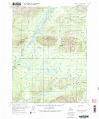
1970 Map of Wiseman A-1
USGS Topo · Published 1977About this map
The Trans-Alaska Pipeline appears in its construction phase on this map, cutting through the Alaskan wilderness alongside the Middle Fork Koyukuk River. This period in the 1970s represents a significant shift in the region's geography as the pipeline corridor introduces a permanent industrial presence to a landscape previously defined by seasonal movement. Transportation relies heavily on the environment, evidenced by the Winter Road and Winter Trail networks that navigate between Twelvemile Mountain and Cathedral Mountain.
Find a feature on this map
32 named features on this map. Tap any name to fly to it.
Don’t see what you’re looking for? This feature index may not catch every label — zoom into the map to look around manually.
Map Details
Editions of this 1970 Wiseman A-1 Map
4 editions found

Other maps of this area

1951 · Bettles
USGS Topo · 1:250,000

1951 · Chandalar
USGS Topo · 1:250,000

1951 · Beaver
USGS Topo · 1:250,000

1951 · Wiseman
USGS Topo · 1:250,000

1956 · Chandalar
USGS Topo · 1:250,000

1956 · Bettles
USGS Topo · 1:250,000

1956 · Wiseman
USGS Topo · 1:250,000

1956 · Beaver
USGS Topo · 1:250,000

1964 · Wiseman
USGS Topo · 1:250,000

1964 · Chandalar
USGS Topo · 1:250,000