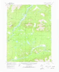
1970 Map of Wiseman A-1
USGS Topo · Published 1977About this map
The Middle Fork Koyukuk River and South Fork Koyukuk River dominate this interior Alaskan landscape, meeting at the western edge of the quadrangle. Steep terrain rises sharply from the riverbanks toward high points like Cathedral Mountain and Twelvemile Mountain, which are separated by Rosie Creek Pass. This 1970s survey, updated with 1975 photogrammetry, shows a wilderness primarily connected by seasonal routes such as the Winter Trail and several landing strips. A solitary Cabin situated along Slate Creek represents the sparse human footprint in this reach of the Yukon-Koyukuk region, while lower elevations are marked by complex drainage systems including Chapman Creek and the marshy expanses near Windy Arm.
Find a feature on this map
1 named feature on this map. Tap any name to fly to it.
Don’t see what you’re looking for? This feature index may not catch every label — zoom into the map to look around manually.
Map Details
Editions of this 1970 Wiseman A-1 Map
4 editions found

Other maps of this area

1951 · Bettles
USGS Topo · 1:250,000

1951 · Chandalar
USGS Topo · 1:250,000

1951 · Beaver
USGS Topo · 1:250,000

1951 · Wiseman
USGS Topo · 1:250,000

1956 · Chandalar
USGS Topo · 1:250,000

1956 · Bettles
USGS Topo · 1:250,000

1956 · Wiseman
USGS Topo · 1:250,000

1956 · Beaver
USGS Topo · 1:250,000

1964 · Wiseman
USGS Topo · 1:250,000

1964 · Chandalar
USGS Topo · 1:250,000