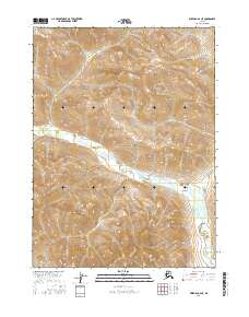
2016 Map of Wiseman C-6 NE
USGS Topo · Published 2016About this map
Gates of the Arctic National Park encompasses the majority of this Alaskan wilderness, where the topographic relief rises from the lowlands of the Shukokluk Creek valley into high alpine ridges. The drainage of Shukokluk Cr serves as the primary hydrologic feature, winding through the southern and central portions of the quadrangle. The absence of roads, settlements, or structures emphasizes the primitive character of this landscape north of the Arctic Circle.
Find a feature on this map
9 named features on this map. Tap any name to fly to it.
Don’t see what you’re looking for? This feature index may not catch every label — zoom into the map to look around manually.
Map Details
Editions of this 2016 Wiseman C-6 NE Map
This is the sole edition of this map. No revisions or reprints were ever made.
Other maps of this area

1951 · Wiseman
USGS Topo · 1:250,000

1956 · Wiseman
USGS Topo · 1:250,000

1964 · Wiseman
USGS Topo · 1:250,000

1971 · Wiseman C-5
USGS Topo · 1:63,360
1971 · Wiseman D-5
USGS Topo · 1:63,360
1986 · Wiseman C-6
USGS Topo · 1:63,360
1986 · Wiseman D-6
USGS Topo · 1:63,360
2016 · Wiseman C-5 SW
USGS Topo · 1:25,000
2016 · Wiseman C-6 SE
USGS Topo · 1:25,000
2016 · Wiseman C-6 NW
USGS Topo · 1:25,000