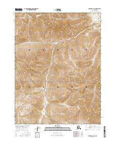
2016 Map of Wiseman C-6 SE
USGS Topo · Published 2016About this map
Gates of the Arctic National Park encompasses the entirety of this topographic landscape, preserving a wilderness area defined by steep elevational shifts and glacial drainage patterns. The interior geography is marked by the northward flow of Shukok Cr and the winding course of Wolverine Cr in the northern sections. These watercourses are vital indicators of the local watershed, cutting through terrain that transitions between various townships, including t32n r23w and t31n r23w. This 2016 survey provides a precise record of the natural topography within one of the most protected and undeveloped regions of Alaska.
Find a feature on this map
7 named features on this map. Tap any name to fly to it.
Don’t see what you’re looking for? This feature index may not catch every label — zoom into the map to look around manually.
Map Details
Editions of this 2016 Wiseman C-6 SE Map
This is the sole edition of this map. No revisions or reprints were ever made.
Other maps of this area

1951 · Wiseman
USGS Topo · 1:250,000

1956 · Wiseman
USGS Topo · 1:250,000

1964 · Wiseman
USGS Topo · 1:250,000

1971 · Wiseman C-5
USGS Topo · 1:63,360
1971 · Wiseman B-5
USGS Topo · 1:63,360
1986 · Wiseman C-6
USGS Topo · 1:63,360
1986 · Wiseman B-6
USGS Topo · 1:63,360
2016 · Wiseman C-5 SW
USGS Topo · 1:25,000
2016 · Wiseman B-6 NW
USGS Topo · 1:25,000
2016 · Wiseman C-6 NW
USGS Topo · 1:25,000