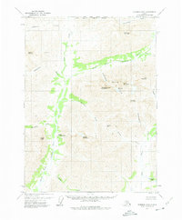
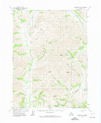
1971 Map of Wiseman D-2
USGS Topo · Published 1975About this map
The North Fork Koyukuk River carves a central path through this section of the Brooks Range, recorded just as the Gates of the Arctic was emerging as a federally recognized wilderness area. The 1970s landscape is defined by massive peaks and high-altitude passes, including the imposing Mount Doonerak and the sharp Frigid Crags. Unlike the developed areas of the lower 48, human presence here is limited to a single Cabin along Ernie Creek, highlighting the extreme isolation of this arctic environment. Topographic details illustrate the drainage patterns of glacial and snowmelt sources like Marshall Lake and Bombardment Creek. This survey captures the region's character as a frontier of scientific study and wilderness preservation, marking the North Slope Borough Boundary and the Fairbanks Meridian across a terrain of high ridges like Boreal Mountain and Wien Mountain.
Find a feature on this map
31 named features on this map. Tap any name to fly to it.
Don’t see what you’re looking for? This feature index may not catch every label — zoom into the map to look around manually.
Map Details
Editions of this 1971 Wiseman D-2 Map
2 editions found
Other maps of this area

1951 · Chandler Lake
USGS Topo · 1:250,000

1951 · Wiseman
USGS Topo · 1:250,000

1956 · Wiseman
USGS Topo · 1:250,000

1956 · Chandler Lake
USGS Topo · 1:250,000

1964 · Wiseman
USGS Topo · 1:250,000

1964 · Chandler Lake
USGS Topo · 1:250,000
1971 · Chandler Lake A-2
USGS Topo · 1:63,360

1971 · Wiseman C-2
USGS Topo · 1:63,360
1971 · Chandler Lake A-1
USGS Topo · 1:63,360
1971 · Wiseman C-1
USGS Topo · 1:63,360