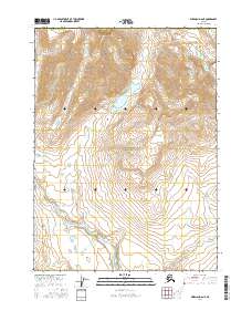
2016 Map of Wiseman D-6 NE
USGS Topo · Published 2016About this map
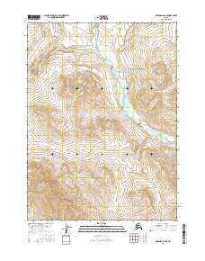
Gates of the Arctic National Park dominates this northern Alaskan interior landscape, centered on a massive alpine drainage system. The high-latitude hydrology is defined by Loon Lake, which feeds into Loon Cr, while the southern reaches are marked by the confluence of the Hunt Fork-John River and Walkaround Cr. To the east, the prominent elevation of Ursus Peak stands as a landmark for navigation. This 2016 survey illustrates the pristine state of the Brooks Range wilderness, showing no permanent settlements or roads within the quadrangle, only the natural progression of braided river systems and glacial lakes like Agiak Creek in the southwest corner.
Find a feature on this map
14 named features on this map. Tap any name to fly to it.
Don’t see what you’re looking for? This feature index may not catch every label — zoom into the map to look around manually.
Map Details
Editions of this 2016 Wiseman D-6 NE Map
This is the sole edition of this map. No revisions or reprints were ever made.
Other maps of this area

1951 · Chandler Lake
USGS Topo · 1:250,000

1951 · Wiseman
USGS Topo · 1:250,000

1956 · Wiseman
USGS Topo · 1:250,000

1956 · Chandler Lake
USGS Topo · 1:250,000

1964 · Wiseman
USGS Topo · 1:250,000

1964 · Chandler Lake
USGS Topo · 1:250,000
1971 · Wiseman D-5
USGS Topo · 1:63,360
1986 · Chandler Lake A-5
USGS Topo · 1:63,360
1986 · Wiseman D-6
USGS Topo · 1:63,360
2016 · Wiseman D-6 SE
USGS Topo · 1:25,000