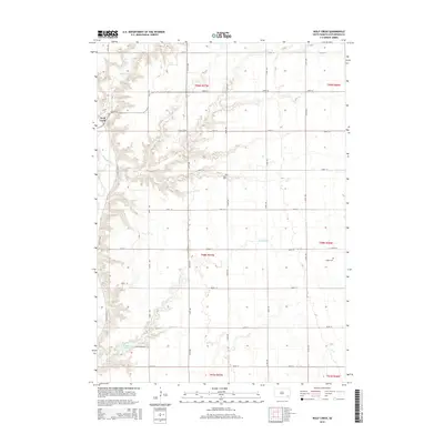
2015 Map of Wolf Creek
USGS Topo · Published 2015About this map
Wolf Creek serves as a central hub for this portion of Hutchinson County, where the eponymous Wolf Creek stream winds through the landscape before joining the James River. The geography is defined by a meticulous section-line road grid, including Colony Rd and County Road 13, which organize the agrarian territory. In the southwest corner, Lake Menno provides a significant water feature, accessed by Lake Menno Rd. The map documents local heritage through the presence of Walz Cem and Huber Cem, which are positioned near the intermittent drainage of Furlong Cr. These small cemeteries and the established colony at Wolf Creek reflect the long-standing communal and family-based settlement patterns characteristic of the South Dakota plains during this era.
Find a feature on this map
32 named features on this map. Tap any name to fly to it.
Don’t see what you’re looking for? This feature index may not catch every label — zoom into the map to look around manually.
Map Details
Editions of this 2015 Wolf Creek Map
This is the sole edition of this map. No revisions or reprints were ever made.
Other maps of this area

1898 · Olivet
USGS Topo · 1:125,000

1898 · Parker
USGS Topo · 1:125,000

1955 · Sioux Falls
USGS Topo · 1:250,000

1957 · Tschetter Colony
USGS Topo · 1:24,000

1957 · Midway
USGS Topo · 1:24,000

1957 · Menno
USGS Topo · 1:24,000

1957 · Clayton
USGS Topo · 1:24,000

1957 · Wolf Creek
USGS Topo · 1:24,000

1957 · Scotland
USGS Topo · 1:24,000

1958 · Sioux Falls
USGS Topo · 1:250,000
Featured Places
- Wolf Creek Hutterite Colony, SD
- Grandview Township, SD
- Kassel Township, SD
- Molan Township, SD
- Sweet Township, SD