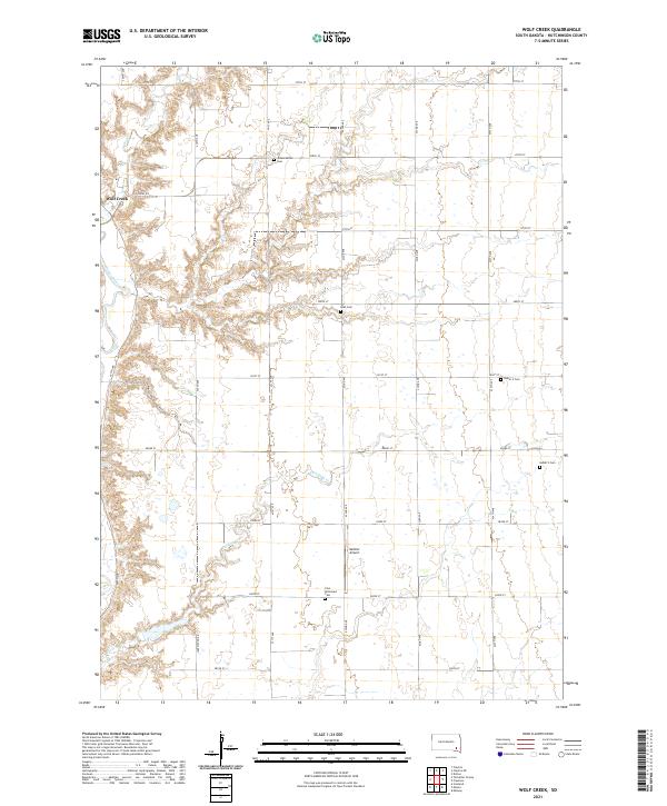
2021 Map of Wolf Creek
USGS Topo · Published 2021About this map
Wolf Creek serves as a central anchor for this part of Hutchinson County, where the settlement and surrounding agrarian landscape are defined by the winding course of the James River. The geography is etched by a series of waterways, including Wolf Cr and Furlong Cr, which carve through the land and dictate the placement of roads and homesteads. The rural nature of the area is underscored by the presence of several established burial grounds, such as the Johannestahl Cem and the Walz Cem, alongside the Zion Reformed Cem. This 2021 survey captures the enduring grid of section roads, including Colony Rd and Lake Menno Rd, which navigate the terrain. The presence of Mettler Airport in the south-central portion of the map indicates how modern transit has integrated into this traditional prairie environment.
Find a feature on this map
34 named features on this map. Tap any name to fly to it.
Don’t see what you’re looking for? This feature index may not catch every label — zoom into the map to look around manually.
Map Details
Editions of this 2021 Wolf Creek Map
This is the sole edition of this map. No revisions or reprints were ever made.
Other maps of this area

1898 · Olivet
USGS Topo · 1:125,000

1898 · Parker
USGS Topo · 1:125,000

1955 · Sioux Falls
USGS Topo · 1:250,000

1957 · Tschetter Colony
USGS Topo · 1:24,000

1957 · Midway
USGS Topo · 1:24,000

1957 · Menno
USGS Topo · 1:24,000

1957 · Clayton
USGS Topo · 1:24,000

1957 · Wolf Creek
USGS Topo · 1:24,000

1957 · Scotland
USGS Topo · 1:24,000

1958 · Sioux Falls
USGS Topo · 1:250,000
Featured Places
- Wolf Creek Hutterite Colony, SD
- Sweet Township, SD
- Grandview Township, SD
- Kassel Township, SD
- Molan Township, SD