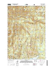
2014 Map of Wolf Peak
USGS Topo · Published 2014About this map
The Salmon River flows through the northern reaches of this section of the Mount Hood National Forest, carving a path north of Mud Creek Ridge and Wolf Camp Butte. This 2014 survey documents a landscape defined by its high-elevation water bodies and drainage networks, with the Pacific Crest National Scenic Trail winding through the eastern corridor. The terrain is marked by significant peaks and meadows, including Wolf Peak and Black Wolf Meadows in the west, while the southern boundary is anchored by the northern waters of Timothy Lake. A network of forest roads, such as Abbott Rd and Linney Creek Rd, provides access to more remote locations like Frying Pan Lake and Meditation Point. The map provides a detailed view of the headwaters for numerous creeks, including Linney Cr and Cooper Cr, which shape the local topography.
Find a feature on this map
34 named features on this map. Tap any name to fly to it.
Don’t see what you’re looking for? This feature index may not catch every label — zoom into the map to look around manually.
Map Details
Editions of this 2014 Wolf Peak Map
This is the sole edition of this map. No revisions or reprints were ever made.
Other maps of this area

1924 · Mount Hood
USGS Topo · 1:125,000

1927 · Mount Hood
USGS Topo · 1:125,000

1953 · The Dalles
USGS Topo · 1:250,000

1956 · The Dalles
USGS Topo · 1:250,000

1956 · High Rock
USGS Topo · 1:62,500

1956 · Mt. Wilson
USGS Topo · 1:62,500

1957 · The Dalles
USGS Topo · 1:250,000
1962 · Government Camp
USGS Topo · 1:24,000
1962 · Timberline Lodge
USGS Topo · 1:24,000
1962 · Rhododendron
USGS Topo · 1:24,000