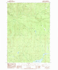
1985 Map of Wolf Peak
USGS Topo · Published 1985About this map
Mt Hood National Forest dominates this mid-1980s terrain, where the northern shores of Timothy Lake meet the high ridges of the Cascades. The map documents a landscape of dramatic recovery and recreation, marked by the expansive Sherar Burn and Abbott Burn alongside modern forestry infrastructure. The presence of multiple extraction sites, including a Quarry, Borrow Pit, and Gravel Pit, indicates the ongoing maintenance of the forest road network that serves the region's diverse campsites.
Find a feature on this map
34 named features on this map. Tap any name to fly to it.
Don’t see what you’re looking for? This feature index may not catch every label — zoom into the map to look around manually.
Map Details
Editions of this 1985 Wolf Peak Map
This is the sole edition of this map. No revisions or reprints were ever made.
Other maps of this area

1924 · Mount Hood
USGS Topo · 1:125,000

1927 · Mount Hood
USGS Topo · 1:125,000

1953 · The Dalles
USGS Topo · 1:250,000

1956 · The Dalles
USGS Topo · 1:250,000

1956 · High Rock
USGS Topo · 1:62,500

1956 · Mt. Wilson
USGS Topo · 1:62,500

1957 · The Dalles
USGS Topo · 1:250,000
1962 · Government Camp
USGS Topo · 1:24,000
1962 · Timberline Lodge
USGS Topo · 1:24,000
1962 · Rhododendron
USGS Topo · 1:24,000