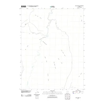
2011 Map of Wolf Point
USGS Topo · Published 2011About this map
Willow Creek carves a winding path through this high desert terrain in Uintah County, creating a complex network of drainage systems such as Main Bottom Canyon and Upper Bottom Canyon. The landscape is defined by massive plateau features, most notably the high elevation of Winter Ridge and the distinct promontories of Horse Point and Wolf Point. Evidence of human presence and land use is sparse but significant, centered around the Cave House site and water management at Weaver Dam.
Find a feature on this map
19 named features on this map. Tap any name to fly to it.
Don’t see what you’re looking for? This feature index may not catch every label — zoom into the map to look around manually.
Map Details
Editions of this 2011 Wolf Point Map
This is the sole edition of this map. No revisions or reprints were ever made.
Other maps of this area

1885 · East Tavaputs
USGS Topo · 1:250,000

1956 · Grand Junction
USGS Topo · 1:250,000

1959 · Grand Junction
USGS Topo · 1:250,000

1960 · Grand Junction
USGS Topo · 1:250,000

1962 · Grand Junction
USGS Topo · 1:250,000

1963 · Tenmile Canyon
USGS Topo · 1:62,500

1964 · Grand Junction
USGS Topo · 1:250,000

1965 · Grand Junction
USGS Topo · 1:250,000

1966 · Bates Knolls
USGS Topo · 1:24,000
1966 · Agency Draw NE
USGS Topo · 1:24,000