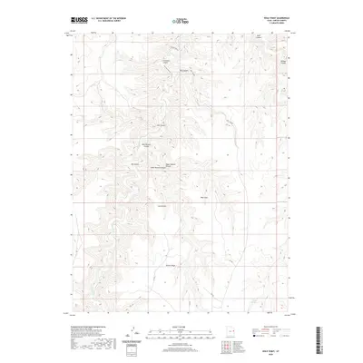
2020 Map of Wolf Point
USGS Topo · Published 2020About this map
Wolf Point and Horse Point dominate this high-desert landscape in Uintah County, where a complex network of drainage systems defines the terrain. The map documents a rugged series of elevations ranging from Main Canyon in the north down to the expansive Winter Ridge in the south. These deep incisions into the plateau, including Ute Canyon and the distinct levels of Upper Bottom Canyon and Lower Bottom Canyon, illustrate the erosional patterns of the region. Water sources are scarce in this environment, with Willow Cr and the isolated Trail Canyon Spring serving as critical landmarks. Transportation is limited to a few remote routes such as Willow Creek Rd, reflecting the area's use for grazing or resource management rather than dense settlement.
Find a feature on this map
15 named features on this map. Tap any name to fly to it.
Don’t see what you’re looking for? This feature index may not catch every label — zoom into the map to look around manually.
Map Details
Editions of this 2020 Wolf Point Map
This is the sole edition of this map. No revisions or reprints were ever made.
Other maps of this area

1885 · East Tavaputs
USGS Topo · 1:250,000

1956 · Grand Junction
USGS Topo · 1:250,000

1959 · Grand Junction
USGS Topo · 1:250,000

1960 · Grand Junction
USGS Topo · 1:250,000

1962 · Grand Junction
USGS Topo · 1:250,000

1963 · Tenmile Canyon
USGS Topo · 1:62,500

1964 · Grand Junction
USGS Topo · 1:250,000

1965 · Grand Junction
USGS Topo · 1:250,000

1966 · Bates Knolls
USGS Topo · 1:24,000
1966 · Agency Draw NE
USGS Topo · 1:24,000