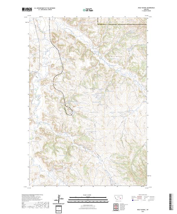
2024 Map of Wolf School
USGS Topo · Published 2024About this map
Little Wolf Mountains dominate the landscape of this region on the border of Treasure and Big Horn counties. This 2024 survey captures a high-elevation drainage system defined by the diverging paths of East Fork Sarpy Creek, Sarpy Creek, and Middle Fork Spring Creek. The map provides a detailed view of the complex hydrology of the high plains, where numerous numbered springs such as 01N37E26ABBB01 Spring and 01N38E08ADBC01 Spring dot the coulees and draws. The presence of these vital water sources underscores the area's importance for cattle ranching and land management in a semi-arid climate. Remote access to these uplands is maintained via Sarpy Rd and Sarpy-Basin Rd, which follow the natural contours of the mountain foothills and creek beds.
Find a feature on this map
47 named features on this map. Tap any name to fly to it.
Don’t see what you’re looking for? This feature index may not catch every label — zoom into the map to look around manually.
Map Details
Editions of this 2024 Wolf School Map
This is the sole edition of this map. No revisions or reprints were ever made.
Other maps of this area

1954 · Hardin
USGS Topo · 1:250,000

1957 · Hardin
USGS Topo · 1:250,000

1958 · Hardin
USGS Topo · 1:250,000

1958 · Chalky Point
USGS Topo · 1:24,000

1967 · Jeans Fork NW
USGS Topo · 1:24,000

1967 · Jeans Fork NE
USGS Topo · 1:24,000

1971 · Mc Clure Creek
USGS Topo · 1:24,000
1971 · Sarpy School
USGS Topo · 1:24,000

1972 · Minnehaha Creek South
USGS Topo · 1:24,000
1972 · Iron Spring
USGS Topo · 1:24,000