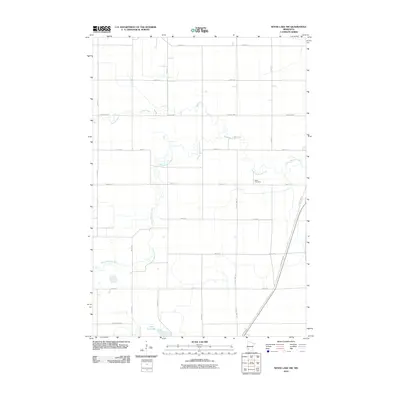
2010 Map of Wood Lake NW
USGS Topo · Published 2010About this map
The Yellow Medicine River meanders sharply across this agricultural landscape, carving a winding path through the prairie of Yellow Medicine County. To the north, Spring Creek feeds into this drainage system, while the southern edge of the quadrangle is anchored by the waters of Lone Tree Lake. The region is defined by a rigorous section-line grid of rural roads, including County Line Rd and several major local arteries like County Hwy-3 and County Hwy-43. This network of roads serves the scattered farmsteads that have long characterized the local economy. For those tracing family history in the area, the West Cemetery serves as a significant landmark situated just north of 200th Ave, providing a concrete link to the generations who settled this part of Minnesota.
Find a feature on this map
23 named features on this map. Tap any name to fly to it.
Don’t see what you’re looking for? This feature index may not catch every label — zoom into the map to look around manually.
Map Details
Editions of this 2010 Wood Lake NW Map
This is the sole edition of this map. No revisions or reprints were ever made.
Other maps of this area

1953 · New Ulm
USGS Topo · 1:250,000

1957 · New Ulm
USGS Topo · 1:250,000

1958 · New Ulm
USGS Topo · 1:250,000

1962 · Wood Lake NW
USGS Topo · 1:24,000

1962 · Cottonwood
USGS Topo · 1:24,000

1962 · School Grove Lake
USGS Topo · 1:24,000

1962 · Wood Lake
USGS Topo · 1:24,000

1965 · Clarkfield
USGS Topo · 1:24,000

1965 · Hazel Run
USGS Topo · 1:24,000
1965 · Granite Falls
USGS Topo · 1:24,000