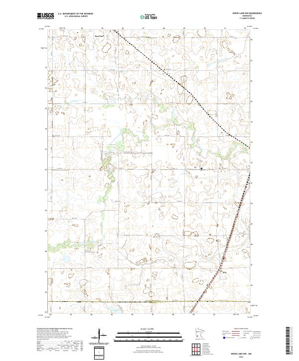
2022 Map of Wood Lake NW
USGS Topo · Published 2022About this map
Hazel Run stands as the primary settlement in this southwestern Minnesota landscape, situated where the prairie begins its transition toward the Yellow Medicine River. The river winds through the central portion of the map, creating a complex drainage network that includes Spring Cr and several engineered waterways like Br R County Ditch Number 9. This topography reflects the intensive agricultural development of the region, where a dense grid of township roads such as Co HWY 18 and Co RD 17 provides access to vast farmsteads.
Find a feature on this map
26 named features on this map. Tap any name to fly to it.
Don’t see what you’re looking for? This feature index may not catch every label — zoom into the map to look around manually.
Map Details
Editions of this 2022 Wood Lake NW Map
This is the sole edition of this map. No revisions or reprints were ever made.
Other maps of this area

1953 · New Ulm
USGS Topo · 1:250,000

1957 · New Ulm
USGS Topo · 1:250,000

1958 · New Ulm
USGS Topo · 1:250,000

1962 · Wood Lake NW
USGS Topo · 1:24,000

1962 · Cottonwood
USGS Topo · 1:24,000

1962 · School Grove Lake
USGS Topo · 1:24,000

1962 · Wood Lake
USGS Topo · 1:24,000

1965 · Clarkfield
USGS Topo · 1:24,000

1965 · Hazel Run
USGS Topo · 1:24,000
1965 · Granite Falls
USGS Topo · 1:24,000