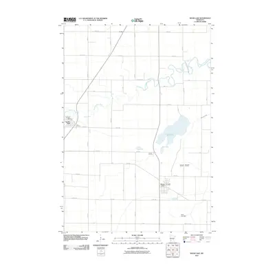
2010 Map of Wood Lake
USGS Topo · Published 2010About this map
The Yellow Medicine River winds through this southwestern Minnesota landscape, defining the rural character of Yellow Medicine County. Centered on the town of Wood Lake, the map documents a region defined by agricultural plots and small prairie settlements like Hanley Falls and the railroad siding of Lorne. The geography here is marked by significant lacustrine features, including the namesake Wood Lake, Mud Lake, and the expansive Sand Lake Bed, suggesting a dynamic hydrological history of the basin.
Find a feature on this map
34 named features on this map. Tap any name to fly to it.
Don’t see what you’re looking for? This feature index may not catch every label — zoom into the map to look around manually.
Map Details
Editions of this 2010 Wood Lake Map
This is the sole edition of this map. No revisions or reprints were ever made.
Other maps of this area

1953 · New Ulm
USGS Topo · 1:250,000

1957 · New Ulm
USGS Topo · 1:250,000

1958 · New Ulm
USGS Topo · 1:250,000

1962 · Wood Lake NW
USGS Topo · 1:24,000

1962 · Cottonwood
USGS Topo · 1:24,000

1962 · School Grove Lake
USGS Topo · 1:24,000

1962 · Wood Lake
USGS Topo · 1:24,000

1965 · Echo
USGS Topo · 1:24,000

1965 · Lone Tree Lake
USGS Topo · 1:24,000

1965 · Hazel Run
USGS Topo · 1:24,000