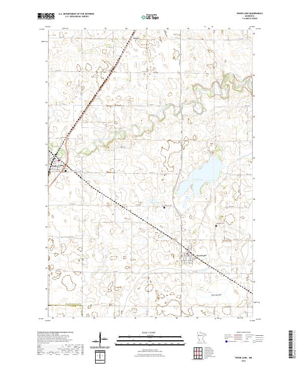
2022 Map of Wood Lake
USGS Topo · Published 2022About this map
Wood Lake and the city that shares its name form the geographic heart of this southwestern Minnesota prairie landscape. The meandering course of the Yellow Medicine River cuts through the northern sections, while the southern terrain is defined by the significant footprint of the Sand Lake Bed, suggesting the region's glacial history and drainage patterns. Three distinct cemeteries—East Cem, Lutheran Cem, and Methodist Cem—provide essential touchstones for genealogical research, marking the historic congregational foundations of the local farming community.
Find a feature on this map
32 named features on this map. Tap any name to fly to it.
Don’t see what you’re looking for? This feature index may not catch every label — zoom into the map to look around manually.
Map Details
Editions of this 2022 Wood Lake Map
This is the sole edition of this map. No revisions or reprints were ever made.
Other maps of this area

1953 · New Ulm
USGS Topo · 1:250,000

1957 · New Ulm
USGS Topo · 1:250,000

1958 · New Ulm
USGS Topo · 1:250,000

1962 · Wood Lake NW
USGS Topo · 1:24,000

1962 · Cottonwood
USGS Topo · 1:24,000

1962 · School Grove Lake
USGS Topo · 1:24,000

1962 · Wood Lake
USGS Topo · 1:24,000

1965 · Echo
USGS Topo · 1:24,000

1965 · Lone Tree Lake
USGS Topo · 1:24,000

1965 · Hazel Run
USGS Topo · 1:24,000