
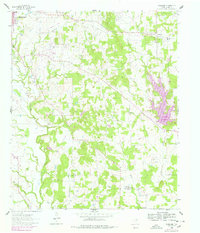
1960 Map of Woodbine
USGS Topo · Published 1964About this map
The eastern edges of Gainesville meet the rolling landscape of eastern Cooke County in this 1960 survey, dominated by the active Anderson Kerr Oil Field and the meandering Elm Fork Trinity River. The map highlights a transition from the developing town infrastructure to a rural economy defined by petroleum extraction and scattered agricultural settlements. Significant cultural landmarks include the Gainesville State School for Girls in the northwest and the Site of Fort Fitzhugh further south, marking early frontier history. Small rural communities and homesteads are anchored by landmarks like the Rad Ware Sch, Mt Lebanon Ch, and several family cemeteries such as Dervin Cem and Redmond Cem. The Missouri Kansas Texas railroad cuts through the north, connecting the settlement of Woodbine to the broader regional network of trade and travel.
Find a feature on this map
27 named features on this map. Tap any name to fly to it.
Don’t see what you’re looking for? This feature index may not catch every label — zoom into the map to look around manually.
Map Details
Editions of this 1960 Woodbine Map
2 editions found
Other maps of this area

1901 · Denison
USGS Topo · 1:125,000

1902 · Gainesville
USGS Topo · 1:125,000

1943 · Gainesville
USGS Topo · 1:125,000

1954 · Sherman
USGS Topo · 1:250,000

1958 · Whitesboro
USGS Topo · 1:62,500

1958 · Sherman
USGS Topo · 1:250,000

1960 · Callisburg
USGS Topo · 1:24,000

1960 · Gainesville South
USGS Topo · 1:24,000

1960 · Gainesville North
USGS Topo · 1:24,000

1961 · Pilot Point
USGS Topo · 1:24,000