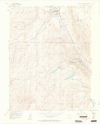
1954 Map of Woodland Park
USGS Topo · Published 1963About this map
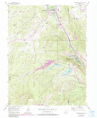
Woodland Park serves as the focal point for this mid-century survey of the Rampart Range foothills. The landscape is characterized by a high-altitude ranching and recreation economy, featuring numerous named properties like Aspen Valley Ranch, Paradise Ranch, and Hidden Valley Ranch. Infrastructure for water and transit dominates the terrain, including the Blue River Pipe Line, an Aqueduct Tunnel, and the historic Old Railroad Grade. To the south, the massive slopes of Pikes Peak rise above the South Catamount Reservoir and Crystal Creek Reservoir. This 1954 data records the eastern edge of the Pike National Forest at a time when mountain tourism was expanding, evidenced by the clusters of development at Green Mountain Falls and Chipita Park. Further south, the Pikes Peak Toll Road winds toward Glen Cove, marking the ascent into the high alpine country.
Find a feature on this map
38 named features on this map. Tap any name to fly to it.
Don’t see what you’re looking for? This feature index may not catch every label — zoom into the map to look around manually.
Map Details
Editions of this 1954 Woodland Park Map
6 editions found

Other maps of this area

1893 · Platte Canyon
USGS Topo · 1:125,000

1893 · Colorado Springs
USGS Topo · 1:125,000

1894 · Pikes Peak
USGS Topo · 1:125,000

1894 · Castle Rock
USGS Topo · 1:125,000

1901 · Pikes Peak
USGS Topo · 1:125,000

1901 · Pikes Peak
USGS Topo · 1:62,500

1909 · Colorado Springs
USGS Topo · 1:125,000

1913 · Castle Rock
USGS Topo · 1:125,000

1942 · Colorado Springs
USGS Topo · 1:125,000

1948 · Manitou Springs
USGS Topo · 1:24,000