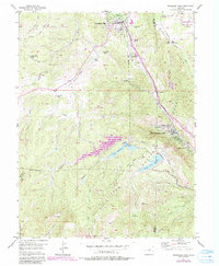
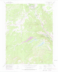
1954 Map of Woodland Park
USGS Topo · Published 1985About this map
Woodland Park and its surrounding mountain communities are captured here in a period of mid-century development, framed by the complex water infrastructure necessary for the high-altitude landscape. The map highlights the significant hydraulic engineering of the era, including the North Catamount Reservoir, South Catamount Reservoir, and the Crystal Creek Reservoir, linked by an aqueduct and a tunnel. This network underscores the region's role as a vital watershed within the Pike National Forest.
Find a feature on this map
46 named features on this map. Tap any name to fly to it.
Don’t see what you’re looking for? This feature index may not catch every label — zoom into the map to look around manually.
Map Details
Editions of this 1954 Woodland Park Map
6 editions found

Other maps of this area

1893 · Platte Canyon
USGS Topo · 1:125,000

1893 · Colorado Springs
USGS Topo · 1:125,000

1894 · Pikes Peak
USGS Topo · 1:125,000

1894 · Castle Rock
USGS Topo · 1:125,000

1901 · Pikes Peak
USGS Topo · 1:125,000

1901 · Pikes Peak
USGS Topo · 1:62,500

1909 · Colorado Springs
USGS Topo · 1:125,000

1913 · Castle Rock
USGS Topo · 1:125,000

1942 · Colorado Springs
USGS Topo · 1:125,000

1948 · Manitou Springs
USGS Topo · 1:24,000