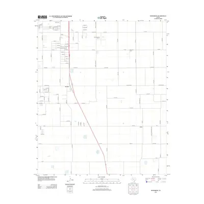
2012 Map of Woodrow
USGS Topo · Published 2012About this map
The community of Woodrow anchors this 2012 survey of the High Plains just south of Lubbock, showcasing a landscape of structured agricultural grids and growing rural-residential development. Small-scale aviation facilities like the Town & Country Airpark and Bartos Farm Airport reflect the region's connection to flight and farm services. The map highlights the intersection of local life and regional transit, with major arteries such as Fm-1585 and Martin L King Blvd cutting through the geometric layout of county roads. Further south, the settlement of Union sits along Farm-To-Market Road 2192, illustrating the dispersal of small communities across the Llano Estacado. This record captures the transition from traditional cotton-country agriculture to more modern infrastructure, marked by the naming of residential streets like University Ave and Ash Ave alongside older farm identifiers.
Find a feature on this map
93 named features on this map. Tap any name to fly to it.
Don’t see what you’re looking for? This feature index may not catch every label — zoom into the map to look around manually.
Map Details
Editions of this 2012 Woodrow Map
This is the sole edition of this map. No revisions or reprints were ever made.
Other maps of this area

1954 · Lubbock
USGS Topo · 1:250,000

1957 · Lubbock East
USGS Topo · 1:24,000

1957 · New Home
USGS Topo · 1:62,500

1957 · Lubbock West
USGS Topo · 1:24,000

1957 · Lubbock
USGS Topo · 1:62,500

1965 · Slaton
USGS Topo · 1:24,000

1965 · Buffalo Springs Lake
USGS Topo · 1:24,000

1965 · Wilson
USGS Topo · 1:24,000

1976 · New Home NW
USGS Topo · 1:24,000

1976 · New Home NE
USGS Topo · 1:24,000