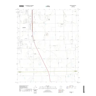
2019 Map of Woodrow
USGS Topo · Published 2019About this map
Woodrow sits at the center of this South Plains landscape, where the southern outskirts of Lubbock meet the wide agricultural reaches of the Panhandle. The map illustrates a transition from the structured street grids of the city, such as 114th St and 130th St, into more rural sections defined by farm roads and small-scale aviation facilities like Lubbock Executive Airpark and Bartos Farm Airport. The north-south corridor of Route 87 serves as the primary artery connecting these communities, passing the Peaceful Gardens Memorial Park as it heads toward the Lubbock County and Lynn County boundary. To the southeast, the small settlement of Union highlights the continued importance of these local centers amidst the vast, geometric layout of cotton and grain fields typical of this region's modern agrarian economy.
Find a feature on this map
58 named features on this map. Tap any name to fly to it.
Don’t see what you’re looking for? This feature index may not catch every label — zoom into the map to look around manually.
Map Details
Editions of this 2019 Woodrow Map
This is the sole edition of this map. No revisions or reprints were ever made.
Other maps of this area

1954 · Lubbock
USGS Topo · 1:250,000

1957 · Lubbock East
USGS Topo · 1:24,000

1957 · New Home
USGS Topo · 1:62,500

1957 · Lubbock West
USGS Topo · 1:24,000

1957 · Lubbock
USGS Topo · 1:62,500

1965 · Slaton
USGS Topo · 1:24,000

1965 · Buffalo Springs Lake
USGS Topo · 1:24,000

1965 · Wilson
USGS Topo · 1:24,000

1976 · New Home NW
USGS Topo · 1:24,000

1976 · New Home NE
USGS Topo · 1:24,000