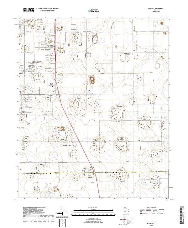
2022 Map of Woodrow
USGS Topo · Published 2022About this map
Woodrow and the southern fringes of Lubbock anchor this High Plains landscape as it appeared in the early 2020s. The region is defined by a dense grid of rural roads and state highways, including Fm 1585, which facilitate the transport of goods across the Llano Estacado. Agricultural and aviation history intersect here at specialized facilities like the Bartos Farm Airport and the larger Lubbock Executive Airpark, illustrating the area's continued reliance on local flight for both commercial and personal use. Along the southern edge, the Lubbock Co Lynn Co line marks the transition into more open territory near Union. The presence of the Peaceful Gardens Memorial Park provides a centered point of local significance within the growing residential and industrial footprint south of the city proper.
Find a feature on this map
57 named features on this map. Tap any name to fly to it.
Don’t see what you’re looking for? This feature index may not catch every label — zoom into the map to look around manually.
Map Details
Editions of this 2022 Woodrow Map
This is the sole edition of this map. No revisions or reprints were ever made.
Other maps of this area

1954 · Lubbock
USGS Topo · 1:250,000

1957 · Lubbock East
USGS Topo · 1:24,000

1957 · New Home
USGS Topo · 1:62,500

1957 · Lubbock West
USGS Topo · 1:24,000

1957 · Lubbock
USGS Topo · 1:62,500

1965 · Slaton
USGS Topo · 1:24,000

1965 · Buffalo Springs Lake
USGS Topo · 1:24,000

1965 · Wilson
USGS Topo · 1:24,000

1976 · New Home NW
USGS Topo · 1:24,000

1976 · New Home NE
USGS Topo · 1:24,000