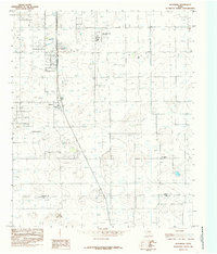
1985 Map of Woodrow
USGS Topo · Published 1985About this map
The community of Woodrow sits at the heart of this High Plains landscape, situated just north of the Lubbock Co Lynn Co boundary line. In the mid-1980s, this area reflects the sprawling development south of Lubbock, where traditional agricultural land-use markers like a Corral and an Aqueduct exist alongside newer recreational and aviation infrastructure. Local flight activity is central to the area's layout, anchored by the Town & Country Airpark and an additional Landing Strip further south.
Find a feature on this map
10 named features on this map. Tap any name to fly to it.
Don’t see what you’re looking for? This feature index may not catch every label — zoom into the map to look around manually.
Map Details
Editions of this 1985 Woodrow Map
This is the sole edition of this map. No revisions or reprints were ever made.
Other maps of this area

1954 · Lubbock
USGS Topo · 1:250,000

1957 · Lubbock East
USGS Topo · 1:24,000

1957 · New Home
USGS Topo · 1:62,500

1957 · Lubbock West
USGS Topo · 1:24,000

1957 · Lubbock
USGS Topo · 1:62,500

1965 · Slaton
USGS Topo · 1:24,000

1965 · Buffalo Springs Lake
USGS Topo · 1:24,000

1965 · Wilson
USGS Topo · 1:24,000

1976 · New Home NW
USGS Topo · 1:24,000

1976 · New Home NE
USGS Topo · 1:24,000