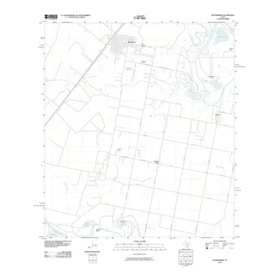
2010 Map of Woodsboro
USGS Topo · Published 2010About this map
Woodsboro serves as the primary municipal center in this coastal plain region, where a structured grid of streets transitions into a vast network of rural routes and oil production sites. The landscape is defined by its drainage patterns, with the winding Mission River and Aransas River carving through the terrain alongside features like Monkey Slough and Chocolate Swale. Local history and genealogy are anchored by sites such as Saint Bernard Cemetery and La Rosa Cemetery, while the industrial footprint of the early 21st century is evident in the La Rosa Oil Field and Bonnie View Oil Field. The map reveals a balance between agricultural flats like Fennessey Flat and smaller named communities such as Bonnie View and Huisache Bend, illustrating the distribution of settlements along the river bends and drainage ways of Refugio County.
Find a feature on this map
40 named features on this map. Tap any name to fly to it.
Don’t see what you’re looking for? This feature index may not catch every label — zoom into the map to look around manually.
Map Details
Editions of this 2010 Woodsboro Map
This is the sole edition of this map. No revisions or reprints were ever made.
Other maps of this area

1953 · Beeville
USGS Topo · 1:250,000

1954 · Rockport
USGS Topo · 1:62,500

1954 · Woodsboro
USGS Topo · 1:62,500

1954 · Vidaurri
USGS Topo · 1:62,500

1954 · Refugio
USGS Topo · 1:62,500

1956 · Beeville
USGS Topo · 1:250,000

1960 · Beeville
USGS Topo · 1:250,000

1978 · Woodsboro
USGS Topo · 1:24,000

1978 · Cranell
USGS Topo · 1:24,000

1978 · Refugio SW
USGS Topo · 1:24,000