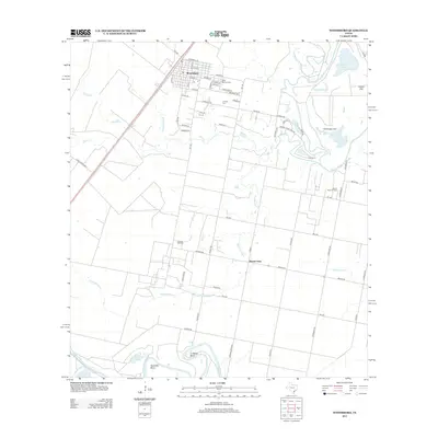
2013 Map of Woodsboro
USGS Topo · Published 2013About this map
Woodsboro and the surrounding coastal plains of Refugio County appear here in a landscape defined by industrial extraction and winding river bottoms. The town is flanked by the La Rosa Oil Field and the Bonnie View Oil Field, illustrating the enduring role of petroleum in the local economy. Religious and community history is anchored at Saint Bernard Cem and La Rosa Cem, while the town's street grid, including Pugh St and Wood Ave, terminates into the open pastureland and marshy drainages characteristic of the Texas Coastal Bend. To the east and south, the Mission River and Aransas River carve out distinct features like Huisache Bend and La Bolsa Bend. Low-lying terrain such as Chocolate Swale and Kaiser Flat dominates the area, showing how the hydrology of the Gulf Coast shapes land use and transportation across the quadrangle.
Find a feature on this map
60 named features on this map. Tap any name to fly to it.
Don’t see what you’re looking for? This feature index may not catch every label — zoom into the map to look around manually.
Map Details
Editions of this 2013 Woodsboro Map
This is the sole edition of this map. No revisions or reprints were ever made.
Other maps of this area

1953 · Beeville
USGS Topo · 1:250,000

1954 · Rockport
USGS Topo · 1:62,500

1954 · Woodsboro
USGS Topo · 1:62,500

1954 · Vidaurri
USGS Topo · 1:62,500

1954 · Refugio
USGS Topo · 1:62,500

1956 · Beeville
USGS Topo · 1:250,000

1960 · Beeville
USGS Topo · 1:250,000

1978 · Woodsboro
USGS Topo · 1:24,000

1978 · Cranell
USGS Topo · 1:24,000

1978 · Refugio SW
USGS Topo · 1:24,000