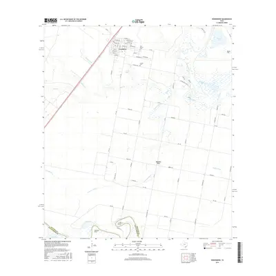
2016 Map of Woodsboro
USGS Topo · Published 2016About this map
Woodsboro serves as the primary hub of this Refugio County landscape, where a dense grid of streets like Danforth St and Summit Ave gives way to expansive agricultural land and coastal river bends. The town site is flanked by the Saint Bernard Cem and La Rosa Cem, offering significant markers for genealogical research in this part of South Texas. The geography is defined by the winding course of the Mission River to the east and the Aransas River at the southern boundary, where the water carves out distinctive landforms such as La Bolsa Bend and Huisache Bend.
Find a feature on this map
71 named features on this map. Tap any name to fly to it.
Don’t see what you’re looking for? This feature index may not catch every label — zoom into the map to look around manually.
Map Details
Editions of this 2016 Woodsboro Map
This is the sole edition of this map. No revisions or reprints were ever made.
Other maps of this area

1953 · Beeville
USGS Topo · 1:250,000

1954 · Rockport
USGS Topo · 1:62,500

1954 · Woodsboro
USGS Topo · 1:62,500

1954 · Vidaurri
USGS Topo · 1:62,500

1954 · Refugio
USGS Topo · 1:62,500

1956 · Beeville
USGS Topo · 1:250,000

1960 · Beeville
USGS Topo · 1:250,000

1978 · Woodsboro
USGS Topo · 1:24,000

1978 · Cranell
USGS Topo · 1:24,000

1978 · Refugio SW
USGS Topo · 1:24,000