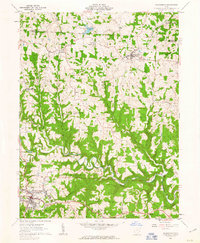
1961 Map of Woodsfield
USGS Topo · Published 1963About this map
Sunfish Creek carves a deep, winding path through the center of this landscape, anchoring a rural Ohio territory defined by its steep ridges and scattered agricultural settlements. As documented in 1961, the area is a mosaic of small-scale industry and community life, featuring numerous gas wells and a strip mine alongside established institutions like the Beallsville High Sch and the Fairgrounds near Woodsfield.
Find a feature on this map
47 named features on this map. Tap any name to fly to it.
Don’t see what you’re looking for? This feature index may not catch every label — zoom into the map to look around manually.
Map Details
Editions of this 1961 Woodsfield Map
3 editions found
Other maps of this area

1905 · Clarington
USGS Topo · 1:62,500

1905 · New Matamoras
USGS Topo · 1:62,500

1905 · Woodsfield
USGS Topo · 1:62,500

1906 · New Martinsville
USGS Topo · 1:62,500

1924 · New Martinsville
USGS Topo · 1:62,500

1924 · New Matamoras
USGS Topo · 1:62,500

1926 · New Martinsville
USGS Topo · 1:62,500

1926 · New Matamoras
USGS Topo · 1:62,500

1935 · Clarington
USGS Topo · 1:62,500

1940 · Clarington
USGS Topo · 1:62,500